The Erosion Potential Model
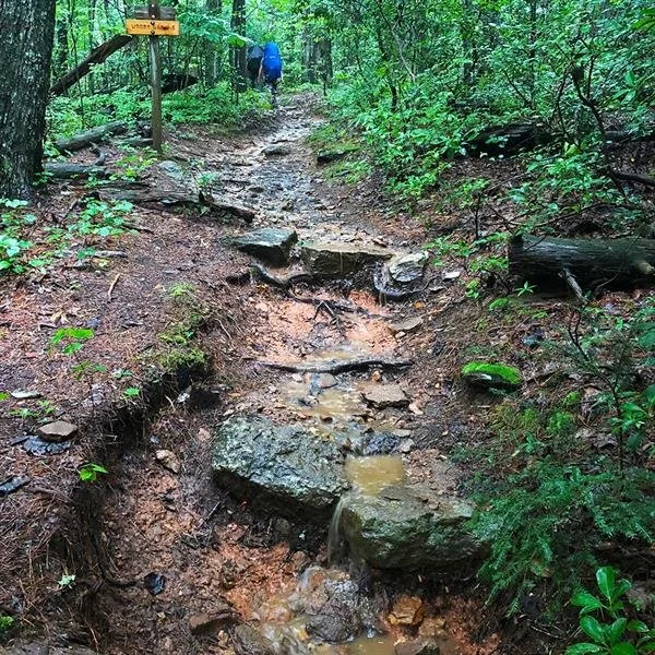
Dupont State Park, North Carolina.
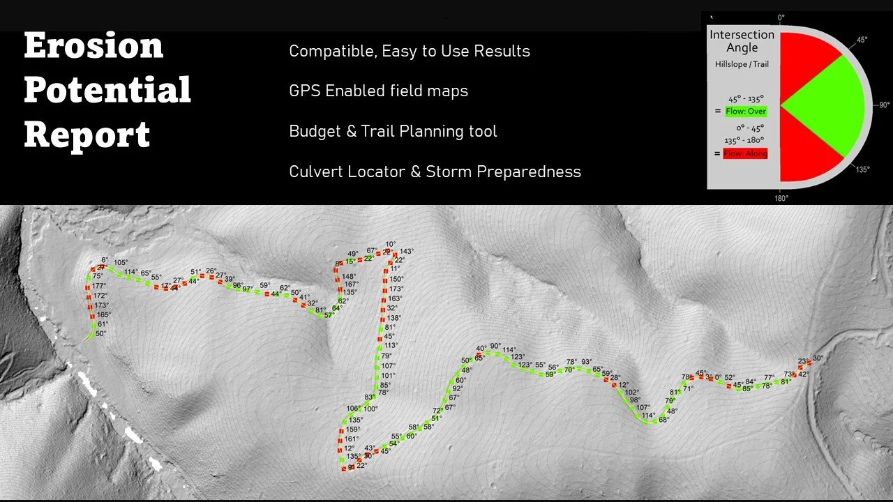
monitoring point interval scaleable from ultra precise (1.5m) to any distance beyond.
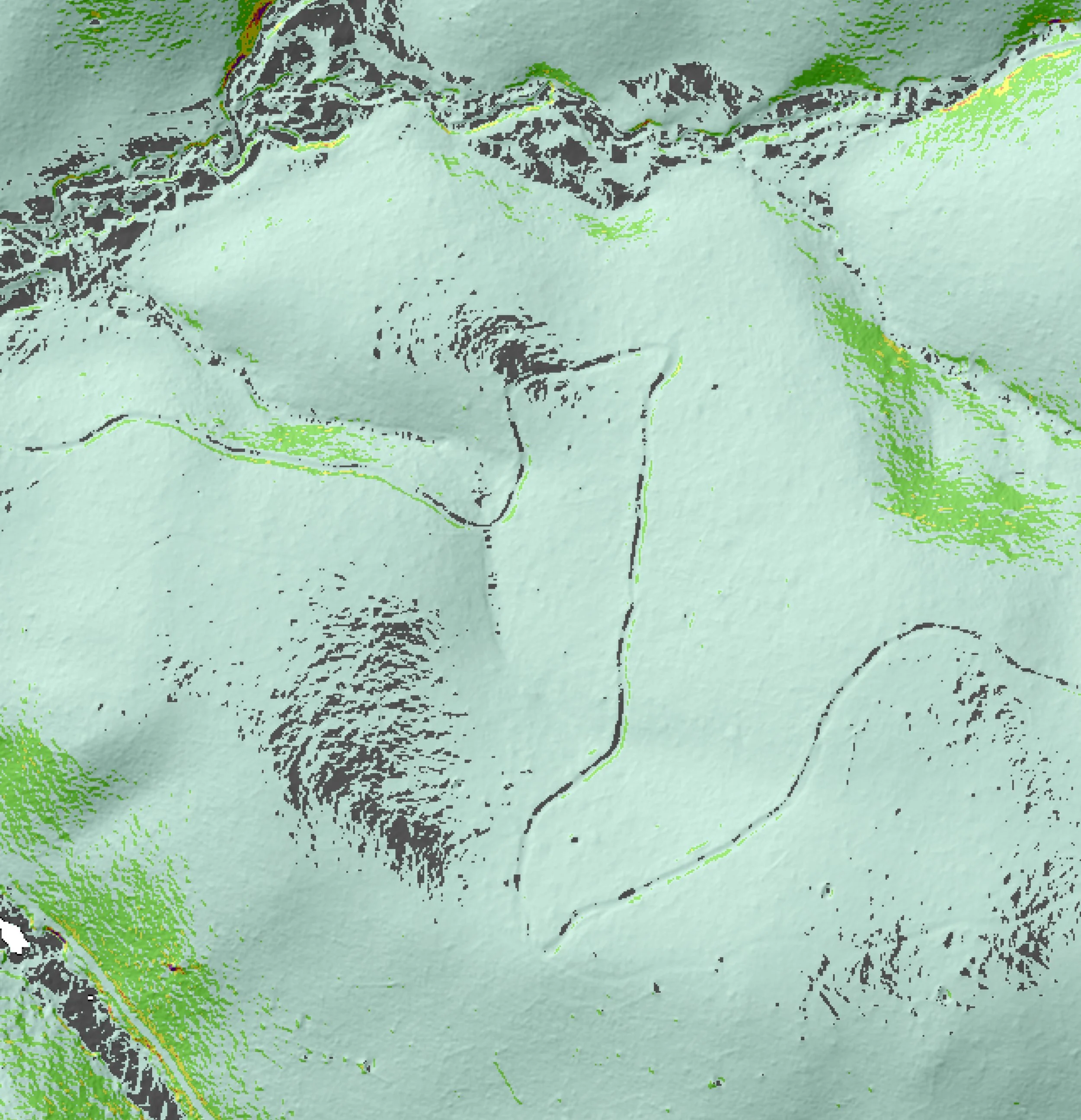
Soil Loss - Mapped
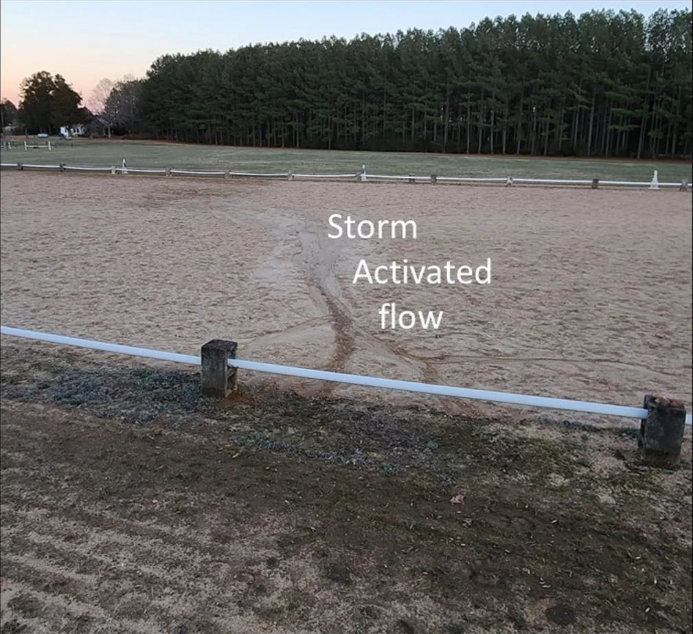
Let us pinpoint your highest risk and most eroded sections of trail.
Our tool reveals the soil loss and erosion fate of ANY linear asset, including fencelines, project boundaries and more. Lidar is the most precise source we use, but standard DEM’s work perfectly well where suitable.
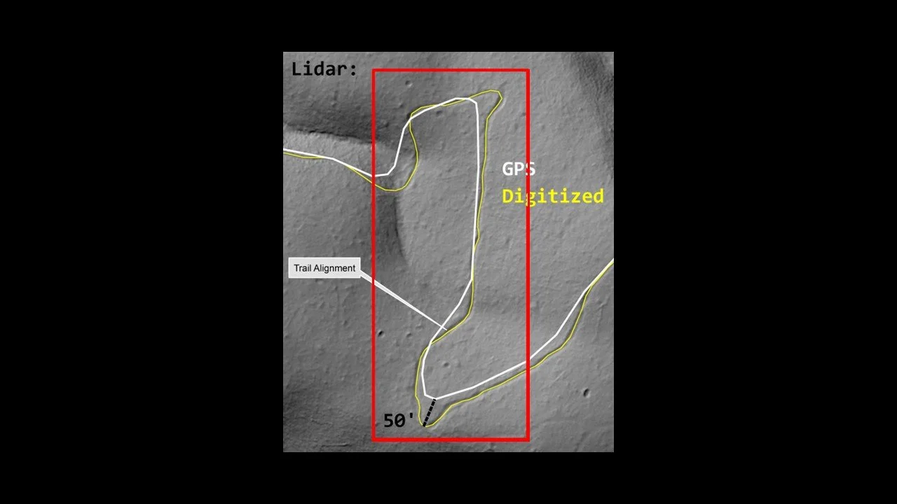
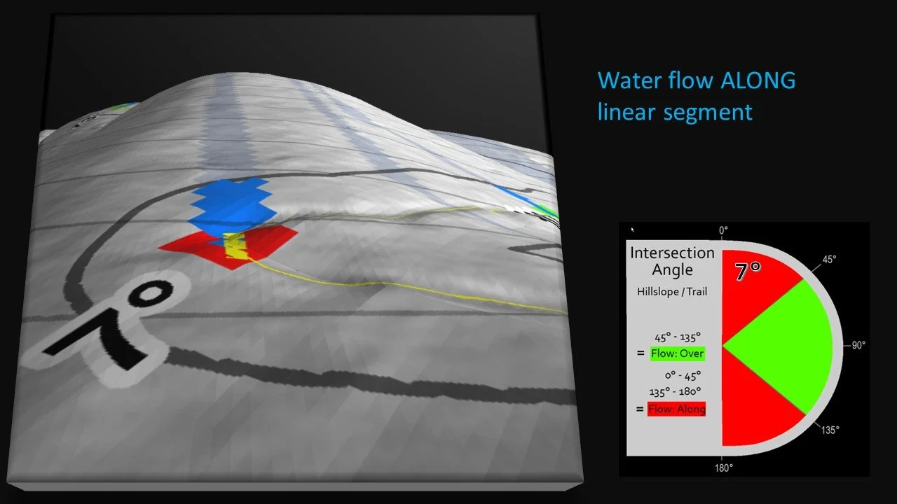
Synchronizing between GPS trail files and lidar is an important first step
for in highest precision reports.
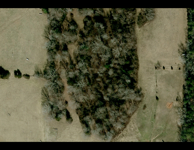
Our lidar toolsets excel where forest cover or persistent shadow hinder imagery based assessments.
“Bare-Earth” landscape and hydrologic analysis offers laser precision trail assessment reporting. Our biogeography parameters account for the absorbtion effects of biomass, woody debris, duff etc. Tune your report dashboard with local precipitation extremes, or norms.

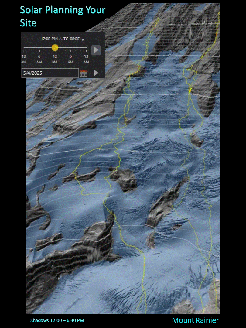
Spatial & Temporal distribution of Sun will influence aspects of trail monitoring and maintenance planning. Lidar typically allows for tree cover to be used as a solar shade parameter, matching real world conditions.
A simple, yet effective routine answers the question.
While we prefer to discuss our tool with trail managers, it’s a lot to take in all at once, we hope this lidar based trail assessment & monitoring tool, built for the budget and maintenance planning needs inherit in any linear asset manager role.
Our linear asset manager tool offers more than we show here, including iterative model runs on your reroutes, or changes to a proposed, or existing trail network.
All our results our ESRI compatible, and can be scaled to sync with any size program.